Having spent the whole summer
working in the
lodge at
Paradise, I had the chance to do some
kick-ass climbing on Rainier and the peaks within Mount Rainier
National Park. But I had never really seen the mountain from its
West and North facing slopes. The summer wouldn't have felt
complete without checking out these remote parts of the mountain.
So I decided to do the 100+ mile Wonderland Trail leading around
the entire volcano. I didnt have all that much time on hand so I
had to pack the normal 10 hiking days into a mere 6.
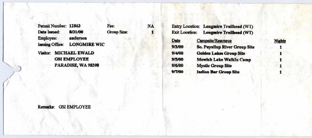
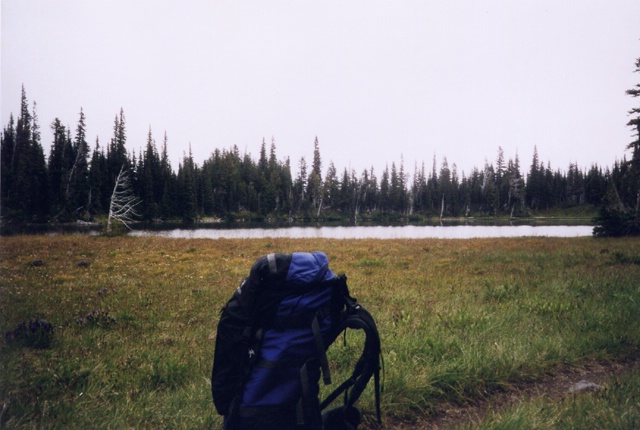
Obligatory campsite permits for the Wonderland Trail
Unfortunately I couldnt find anyone to join me for the hike so
I had to go solo. I tried to minimise the weight of my pack
knowing that every ounce less would make it more comfortable to
hike. I didnt really bring any spare clothes, just food, cooking
equipment, my sleeping bag and my tent - 12 kgs, the bare minimum.
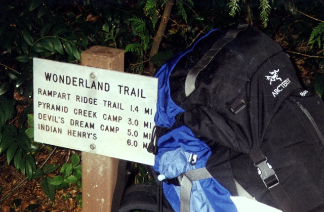
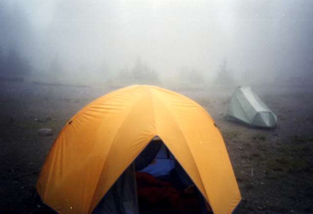
Starting to hike at Longmire
I took the employee van down to Longmire where I began my hike
on the trail leading to Indian Henrys Hunting Ground. The moment
that I started walking it began to rain. It turned out that it
wouldnt really stop raining apart from a few hours now and then
until I finished the hike 6 days later!
Indian Henrys Hunting Ground
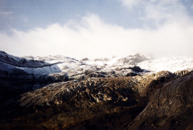
When I got to the meadows of Indian Henrys the clouds lifted a
little bit and I could see fresh snow not much higher from where I
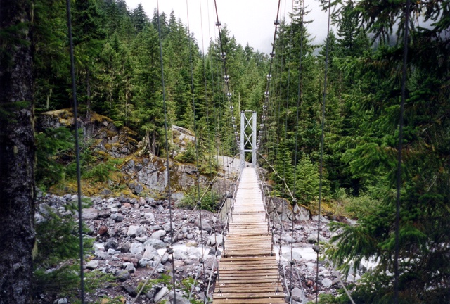
was. Great! I followed the trail down to the suspension bridge
(seen
here in good weather)
over the Tahoma creek. I had gotten this far already earlier in
the summer on a day hike from Longmire, but in much better
weather (like
this or like
this). The trail then gradually rose up Emerald Ridge towards
the huge Tahoma Glacier.
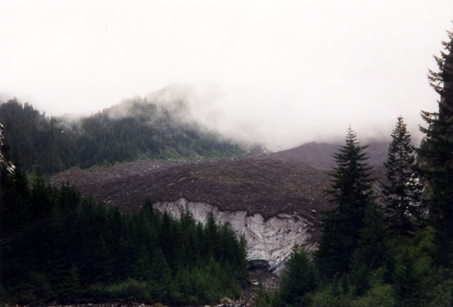
The snout of the Tahoma Glacier
Up on the ridge I caught a cool glimpse of the Tahoma whose snout
ended a few hundred vertical feet below the trail. The ice looked
really black!
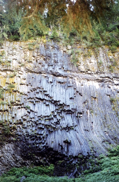
Strange volcanic rock formations
Just before the South Puyallup Camp some cool volcanic rock
formations were visible on a rock face next to the trail. At the
camp I ran into a bunch of other people, but most of them were
about to complete the Wonderland Trail having chosen to
circumnavigate the mountain counter-clockwise. After an easy to
prepare maccaroni & cheese dinner, I used the remaining day light
to start reading my new book on the yeti by Reinhold Messner. The
next morning I woke up to drizzle and fog. I packed the wet tent
into my backpack, had some maccaroni (yes, breakfast & dinner carb
diet) and made my way up the steep serpentines to St Andrews Park.
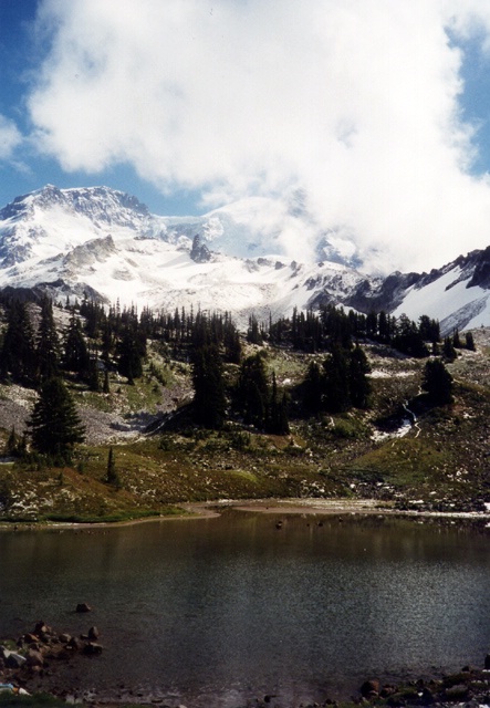
St Andrews Lake
The meadows up there turned out to be snow covered and when I
reached St Andrews Lake the clouds lifted for a few moments and I
got a glimpse of Mt Rainier and the snow covered Puyallup Glacier.
The trail then passed by Klapatche Park Camp where I read a note
about bear sightings near Golden Lakes. Cool, maybe I would get to
see my first bear that season at Rainier!
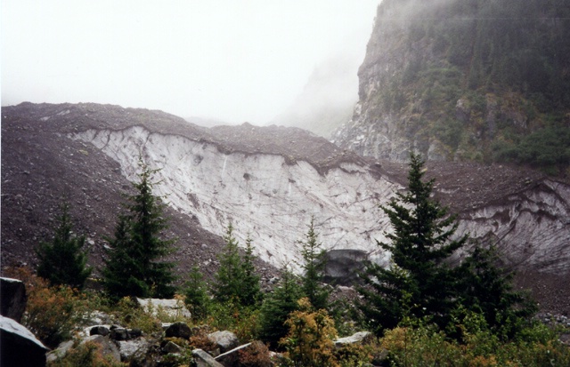
The snout of the Puyallup Glacier peeking over the headwall
After a steep descent down into the North Puyallup River
valley, the sun came out again for a few minutes and I could see
one of the snouts of the Puyallup Glacier hanging over a rock face
in the valley's headwall. The trail then began its long, gradual
ascent to Golden Lakes.
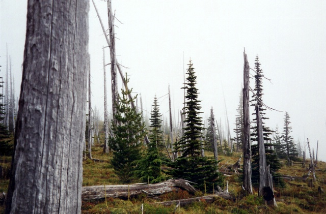
Dead forest close to Golden Lakes
The walk through the forest was really boring and it wasn't all
that much fun having noone to talk to. Being lonesome out in the
wild makes you think too much weird stuff I guess.
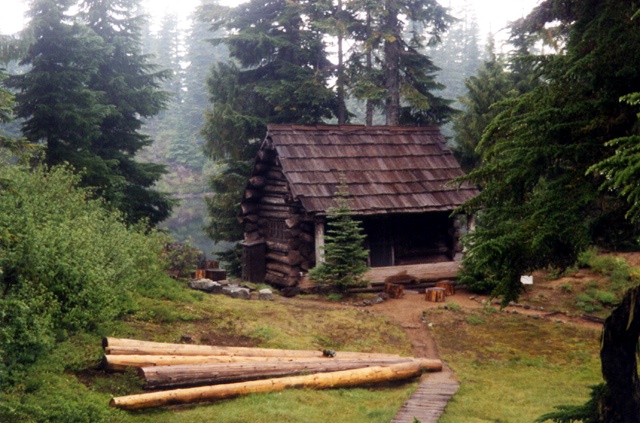
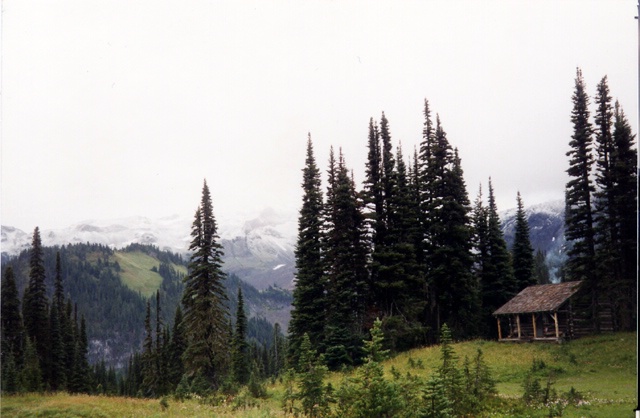
Golden Lakes ranger cabin
At Golden Lakes I cooked dinner on the patio of a little
unmanned ranger hut and set up my tent in the drizzly weather. I
was the only there that night at Golden Lakes.
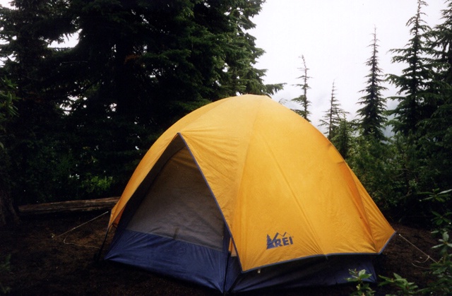
Camping in the rain at Golden Lakes
The next day I took a leisurely start since the hike to Mowich
Lake was gonna be shorter than the previous day's stretch (only
about ten miles). After a few minutes hiking I shrugged...a tiny
bear was hopping over the trail 50 meters ahead of me. I didn't
seem to notice me but I knew that a cub is never far away from its
mom, so I froze. The mom ended up not coming, I guess she had been
ahead of its cub and had already dissappeared into the dense
forest, pheeww! Unfortunately I didnt have the guts to take out my
camera and take a picture of the bear.
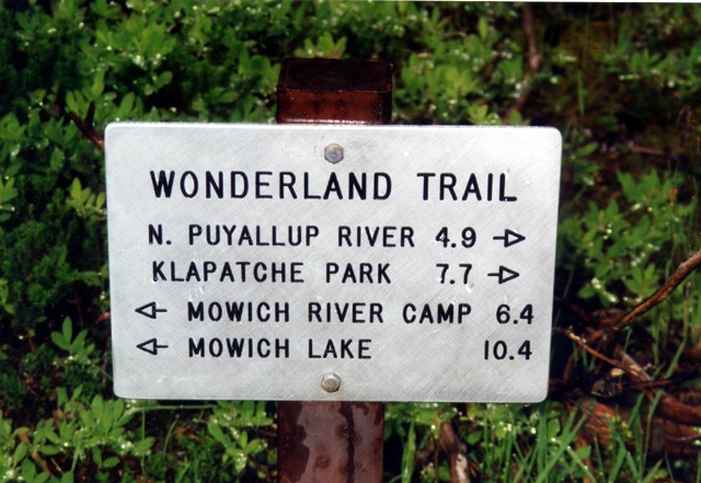
Distances shown from Golden Lakes
The trail then zick-zacked down into the North Mowich River
valley, which was pretty since the sun came out once again and
strangely illuminated the dense old growth forest.
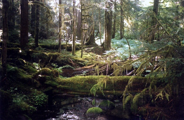
Old growth at North Mowich River
I met an old ranger on patrol close to the wodden shelters down
in the valley and then started the long climb up to Mowich Lake.
Up at the lake, the weather turned absolutely miserable and it
down-poured like crazy. There was another tent set up by a guy
called Joe Kadic.
Camping at Mowich Lake
It was great to finally talk to someone for a longer period of
time after being on my own for so long. I was starving and sick of my
awful macaroni & cheese dinners and he offered me some of his
delicious beef jerky. He had been on the trail already for 8 days
or so and was circumnavigating Rainier in the opposite direction
as I did. He took a picture of me with my camera in front of
Mowich Lake. It turned out it was the only picture featuring me as
a motive and not my backpack :-).
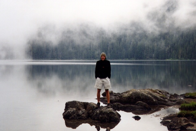
Mowich Lake
The next day I got up early and started to hike up Ipsut Pass
and then down into the Ipsut valley along the Ipsut Creek in pouring rain. I passed a
big boulder just after the pass and a fat marmot was just sitting
on it in the rain doing nothing. Funny!
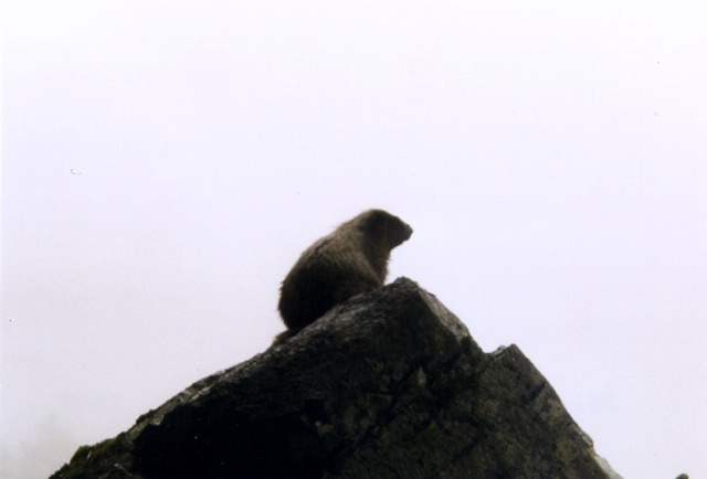
Ipsut Pass Marmot
The trail descended into extremely dense old growth rain
forest. A pretty cool sight, but kind of spooky too being all
alone. The trail reached its Northern apex - and possibly its
lowest elevation - at Ipsut Falls and then turned into the Carbon
River valley.
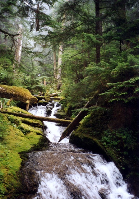
Old growth rainforest near Ipsut Falls
After a while I finally could see the infamous Carbon Glacier,
the lowest-reaching glacier in the continental USA. The snout
looked like it rammed straight into the forest.
The snout of the Carbon Glacier
Crossing the Carbon River
The glacier was completely covered in rocks and
the amazing thing was that there were actually small trees growing
ON the glacier! I crossed the suspension bridge over the Carbon
River just befor the snout of the glacier and got some good views
of the glaciers "mouth".
The snout once again
The trail then ascended gently along the massive Carbon Glacier
(which had already been engulfed by dense fogs and allowed for no
views). In the meadows of Moraine Park I met tons of marmots and
two Swiss girls who were on their way to Ipsut Creek Ranger
station. After another hour or so I finally reached my destination
of the day: Mystic Lake.
Mystic Lake
And mystic it was! Again I was the only person camping at this
foggy patch of the world. At least I accidentally ran into
luxurious five star toilet faciltities close to camp.
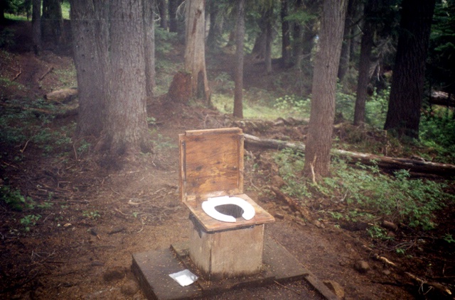
Open air casino!
The next morning I woke up to brillantly blue skies and hit the
trail in good spirits. After an hour I crossed the snout of the
Winthrop Glacier and took a picture of my loyal friend HAT in
front of the infamous North Face of Mt Rainier.
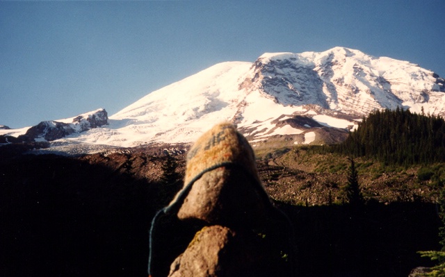
from l.t.r.: Steamboat Prow/Camp Schurman - Winthrop Glacier -
Curtis Ridge - Willis Wall
The hike up Burroughs Mountain was hot, dusty and took ages. I
got to Sunrise in the early afternoon and bought all kinds of
crappy food at the snack shop. Being back in civilization felt
strange but good! I had quite a stretch of walking left to do, my
goal was to reach Indian Bar Camp, which was another 10 miles from
where I was. I thought I could save a little bit of time by
short-cutting the hike from Sunrise to White River by
hitch-hiking down the road. I waited ages before someone picked me up. Finally a
ranger gave me a ride and when I got down to White River it was
already 4pm. No way I would make it before dark to Indian Bar!
Having hiked already the stretch up to Panhandle Gap earlier in
the summer, I told myself to call it a day and postpone the only
missing part of the Wonderland Trail that I hadnt hiked (Panhandle
Gap - Indian Bar - Nickel Creek) to the future. A nice guy from
Guest Services Inc., the company I was working for that summer,
picked me up in his truck and we drove together back to Paradise.
Felt good to be back! A shower, my girl and a hearty meal at the
Inn rounded-off the five day excursion around 3/4 of Rainier.
